Srah Beach
Srah Beach is on the EPA's list of places people swim, though not one of the waters it tests in County Mayo, 4 km south-west of Bunnahowen. The State does not test the water here, so there is no grade. The register records toilets and a lifebuoy. It leaves 2 of the questions on this page unanswered, and those are shown as not recorded rather than as a no.
- Water quality
- Not monitored for a classification
- Water testing
- Not tested by the EPA on its list, but not sampled for a grade
- Season restriction
- Not recorded
- Pollution after rain
- Not recorded
- Awards
- Green Coast · the register does not say which year's award
- County
- County Mayo
- Managed by
- Mayo County Council
- Nearest town
- Bunnahowen, 4 km south-west of it, in a straight line
- From that town
- 5 km by road, about 10 min drivingor 5 km on foot, about 63 minutes at 4.8 km/h
- Lifeguard
- No
- Toilets
- Yes
- Parking
- No
- Access
- No
- Dogs
- Allowed on a lead
- Cars on the beach
- No
- Public transport
- No
- Protected area
- Recorded as a natural sensitive area
- Position
- 54.1722° N, 9.9568° W
- Record changed
- 2021-06-28


What the EPA says about it
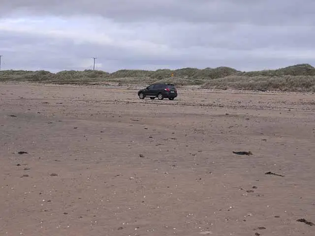
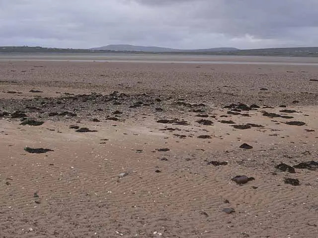
Srah Beach is a long sandy beach on the north eastern corner of Blacksod Bay. The beach gets its name from the Irish Word 'Sraith' which refers to the stretch of sand that connects Claggan Island to the mainland and makes up this beautiful sandy beach. The beach forms part of the Blacksod Bay/Broadhaven Special Protection Area (SPA), and the Mullet/Blacksod Bay Complex Special Area of Conservation (SAC).
Where it is
Srah Beach, and the other places to swim in County Mayo. Share your position and the map will show how far each one is from you.
Getting to Srah Beach
About these directions
Public transport times come from National Transport Authority. Timetables cover 2026-09-18 to 2027-09-19. These are scheduled services; check with the operator for cancellations and changes before travelling.
Walking and driving times are estimates. A town search starts at its centre; choose your location or a point on the map for a more precise starting point. Eircode search is not available.
How journey planning worksDestination, access and nearby stops
Srah Beach is in Bunnahowen, County Mayo. Routes here end at the point the map records for this place. The entrance has not been verified, so the last few metres are for you to judge.
The nearest scheduled stop is An tSraith (13891), 1.6 km away in a straight line. Use the planner to check walking connections for your journey.
- An tSraith 1.6 km
bus 946Scheduled departures from this stop
Getting to Bunnahowen covers the journeys into the town itself.
Other places to swim in County Mayo
- Belmullet Tidal Pool & Shore Road Bathing Area
- Bertra Beach, MurriskBlue Flag
- Carrowmore Beach, Louisburgh
- Carrowniskey, Louisburgh
- Clare Island, LouisburghBlue Flag
- Cross Beach Louisburgh
- Cross Beach, Belmullet
- Dooega Beach, Achill IslandBlue Flag
- Dugort Beach, Achill IslandBlue Flag
- Elly Bay, BelmulletBlue Flag
- Golden Strand, Achill Island
- Keel Beach, Achill IslandBlue Flag
- Keem Beach, Achill IslandBlue Flag
- Mullaghroe Beach, BelmulletBlue Flag
Questions people ask
Is the water clean at Srah Beach?
Is swimming restricted at Srah Beach?
Does Srah Beach have a Blue Flag?
Is there a lifeguard at Srah Beach?
How do you get to Srah Beach without a car?
Where does this come from?
Water quality, awards, lifeguards, toilets, parking and access are the Environmental Protection Agency’s own fields, from its bathing water register, read 2026-09-20. The classification covers four years of sampling and is not a reading for today: after heavy rain the water can be worse than the classification suggests, and the EPA and the local authority post notices when it is. Positions are the EPA’s grid references, projected to latitude and longitude. Journeys are the National Transport Authority’s published timetable.
Beaches and bathing waters in Ireland·Beaches in County Mayo