Rothe family, Kilkenny
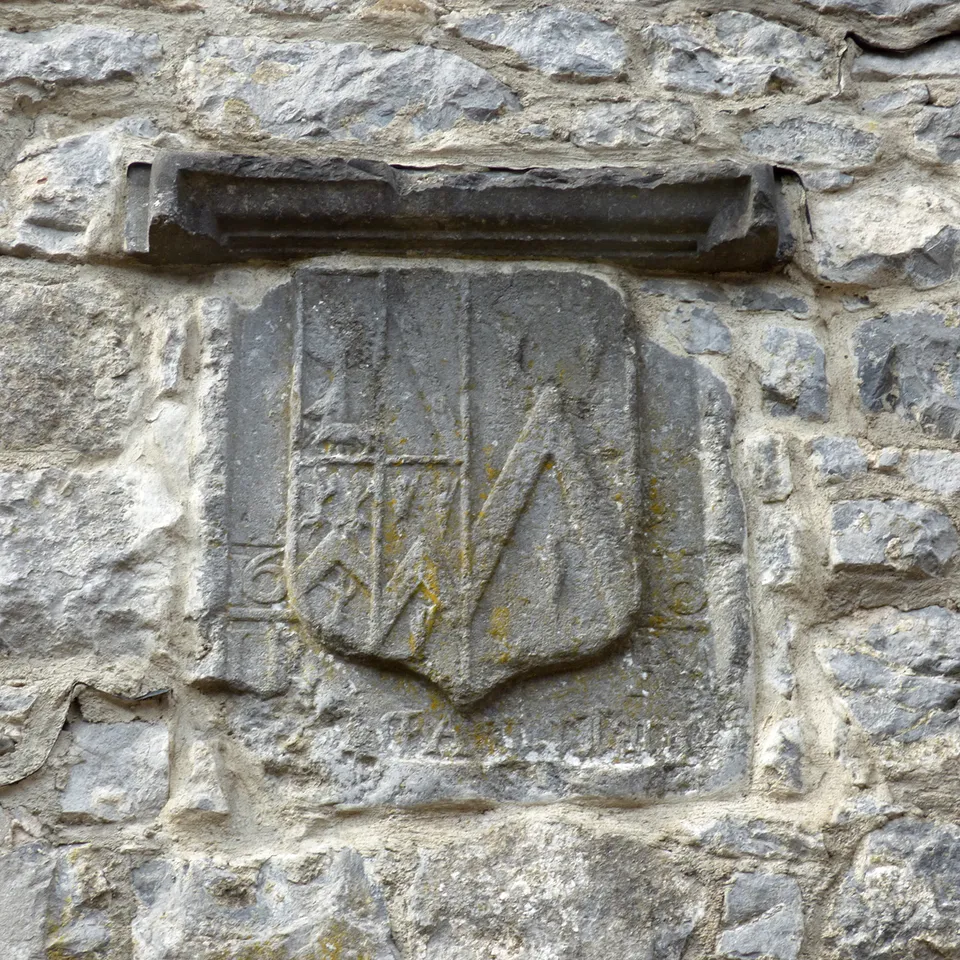
Rothe family is a monument near New Building Lane in Kilkenny, County Kilkenny, 470 m north-west of the centre. Timothy O'Hanrahan is within 20 m.
1610 JR RA
- Kind
- Monuments
- Nearest road
- New Building LaneThe closest named road, measured here. The map records no address for this place, so this is not a statement about where its door is.
- From the centre
- 470 m north-west, in a straight line
- Dated
- 1610
- Parking
- Market Cross Car Park, 90 m away
- Bus stop
- Parliament Street, 70 m away

Getting to Rothe family
About these directions
Public transport times come from National Transport Authority. Timetables cover 2026-09-18 to 2027-09-19. These are scheduled services; check with the operator for cancellations and changes before travelling.
Walking and driving times are estimates. A town search starts at its centre; choose your location or a point on the map for a more precise starting point. Eircode search is not available.
How journey planning worksDestination, access and nearby stops
Rothe family is in Kilkenny, County Kilkenny. Routes here end at the point the map records for this place. No entrance has been verified, so the last few metres are for you to judge. Black Abbey Car Park is 120 m away and the map records it as open to the public.
The nearest scheduled stop is Parliament St (10291), 80 m away in a straight line. Use the planner to check walking connections for your journey.
- Parliament St 80 m
buses KK1 and KK2Scheduled departures from this stop
- Market Yard 140 m
buses KK2, KK1 and 838Scheduled departures from this stop
- Dean Street 210 m
buses KK1 and KK2Scheduled departures from this stop
- Dominic Street 360 m
buses KK1 and IW01Scheduled departures from this stop
- Butt's Green 370 m
bus KK2Scheduled departures from this stop
Getting to Kilkenny covers the journeys into the town itself.
Events nearby
Not at Rothe family. These are at other venues within a few hundred metres of it.
- 22 to 26 October 2026Free and ticketed partsSavour Kilkenny Food Festival 2026Kilkenny City
- 23 to 26 October 2026TicketedA Samhain Medieval FeastRothe House & Garden
- 29 October 2026TicketedToil and Trouble ~ The Juniper Tree, Movie Screening with Live ScoreWatergate Theatre
- 29 October to 1 November 2026Free and ticketed partsKilkenny's Toil & TroubleKilkenny
Within a short walk
What else the map names within four hundred metres of Rothe family, on New Building Lane and around it.
- 0 m
- Timothy O'Hanrahan20 mMonuments
- Rothe House & Garden20 mTicket
- The Merchant's Shop30 mGift shops
- River Nore Music Academy40 mMusic school
- Made By Italian40 mRestaurants
Also on New Building Lane
New Building Lane carries 5 of the places the map names in Kilkenny.
Other monuments in Kilkenny
Nearest to Rothe family first, and the figure beside each one is how far it is from Rothe family, in a straight line. Same point, same measure.
- Timothy O'Hanrahan10 mNew Building Lane
- Black Friars Gate80 mAbbey Gardens
- Confederate Hall90 mMarket Yard
- Thomas Woodgate Monument100 mMarket Yard
- Black Abbey Carpark120 mNew Row
- Christian Brothers130 mJames's Street Sconce
- City Walls140 mWatergate
- Elias Shee coat-of-arms190 mHigh Street
- Shee200 mSaint Kieran's Street
- Riverside Garden and Skatepark Kilkenny210 mMarket Yard
- Market Yard Gates280 mCoach Road
- Kilkenny World War I Memorial 1914-1918290 mMichael Street
Questions people ask
Where is Rothe family?
What are the opening hours of Rothe family?
How far is Rothe family from the centre of Kilkenny?
Are there other monuments near Rothe family?
How do you get to Rothe family without a car?
Where this comes from
- From the map
- The name, the kind of place, the address where the record carries one, and any website, phone or opening hours shown as recorded on the map are tags on OpenStreetMap node/7859482792, and can be corrected there.
- Worked out here
- Every distance, the nearest road where the record has no address, which car park and which stop are nearest, and the order of the lists are this site’s own calculations from those records. Distances are straight lines between two points, not walks along the footpaths, and the map will route the real walk on request. A mistake in any of this is a mistake here rather than on the map.