William Smith O'Brien Monument, near Blanchardstown
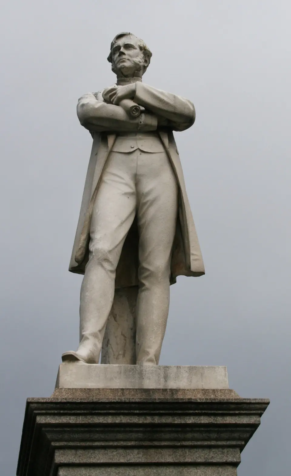
A standing figure of William Smith O'Brien, the Young Irelander, on the pedestrian median of O'Connell Street Lower. Thomas Farrell carved it in Portland limestone and it was put up in 1870, though not here: it stood on D'Olier Street until 1929, when it was moved to O'Connell Street.
William Smith O'Brien Born 17th October 1803 Sentenced to Death for High Treason on the 9th October 1848 Died 16th June 1864
- Kind
- Monuments
- From Blanchardstown
- 9.1 km south-east, in a straight line

Getting to William Smith O'Brien Monument
About these directions
Public transport times come from National Transport Authority. Timetables cover 2026-09-18 to 2027-09-19. These are scheduled services; check with the operator for cancellations and changes before travelling.
Walking and driving times are estimates. A town search starts at its centre; choose your location or a point on the map for a more precise starting point. Eircode search is not available.
How journey planning worksDestination, access and nearby stops
William Smith O'Brien Monument is in Blanchardstown, County Dublin. Routes here end at the point the map records for this place. No entrance has been verified, so the last few metres are for you to judge.
The nearest scheduled stop is O'Connell St Lwr (271), 40 m away in a straight line. Use the planner to check walking connections for your journey.
- O'Connell St Lwr 40 m
buses 1, 122, 11, 44, 11B and 53 among othersScheduled departures from this stop
- Abbey St 50 m
buses 980, 980B and 980AScheduled departures from this stop
- O'Connell - GPO 70 m
bus GreenScheduled departures from this stop
- Abbey St. 80 m
bus RedScheduled departures from this stop
- Eden Quay 90 m
buses 245X, 22, 23, 735 and 191Scheduled departures from this stop
Getting to Blanchardstown covers the journeys into the town itself.
Events nearby
Not at William Smith O'Brien Monument. These are at other venues within a few hundred metres of it.
- 10 to 18 October 2026Free entryOpen House Dublin 2026Various Locations, Dublin
- From 11 November 2025. Closing date to be confirmedFree entryLive Aid ExhibitionNational Photographic Archive
- 25 September to 1 November 2026TicketedMeredithGate Theatre
- 25 September to 1 November 2026TicketedMeredith by Erica MurrayGate Theatre
Its own account of its history
- 1803William Smith O'Brien was born.
- 1864He died.
- 1870The monument was put up on D'Olier Street, carved by Thomas Farrell.
- 1929It was moved to O'Connell Street Lower, where it stands now.
These are the dates the National Inventory of Architectural Heritage records under registration 50010513, which rates the monument of regional importance. The inscription itself is not transcribed there, so it is not quoted here. National Inventory of Architectural Heritage, source, read on 2026-09-21.
What to see
- The figure is in mid nineteenth century dress and faces south
- Portland limestone on a granite pedestal, plinth and a four tier stepped base
- A recessed inscribed panel on the south face, in Irish and English
As National Inventory of Architectural Heritage describes them, read on 2026-09-21. Nothing here is an account of a visit: this site has not been.
Other monuments in Blanchardstown
Nearest to William Smith O'Brien Monument first, and the figure beside each one is how far it is from William Smith O'Brien Monument, in a straight line. Same point, same measure.
- 20 m
- 30 m
- 60 m
- 120 m
- 140 m
- 170 m
- 180 m
- 190 m
- 200 m
- 220 m
- 250 m
- 270 m
Questions people ask
Where is William Smith O'Brien Monument?
What are the opening hours of William Smith O'Brien Monument?
How far is William Smith O'Brien Monument from the centre of Blanchardstown?
Are there other monuments near William Smith O'Brien Monument?
How do you get to William Smith O'Brien Monument without a car?
Where this comes from
- From the map
- The name, the kind of place, the address where the record carries one, and any website, phone or opening hours shown as recorded on the map are tags on OpenStreetMap node/6279642664, and can be corrected there.
- Worked out here
- Every distance, the nearest road where the record has no address, which car park and which stop are nearest, and the order of the lists are this site’s own calculations from those records. Distances are straight lines between two points, not walks along the footpaths, and the map will route the real walk on request. A mistake in any of this is a mistake here rather than on the map.
- Sources for the visitor information on this page. National Inventory of Architectural Heritage: Registration 50010513, read 2026-09-21
Back to Blanchardstown·Getting to Blanchardstown·Monuments in Blanchardstown