National Monument, Cork
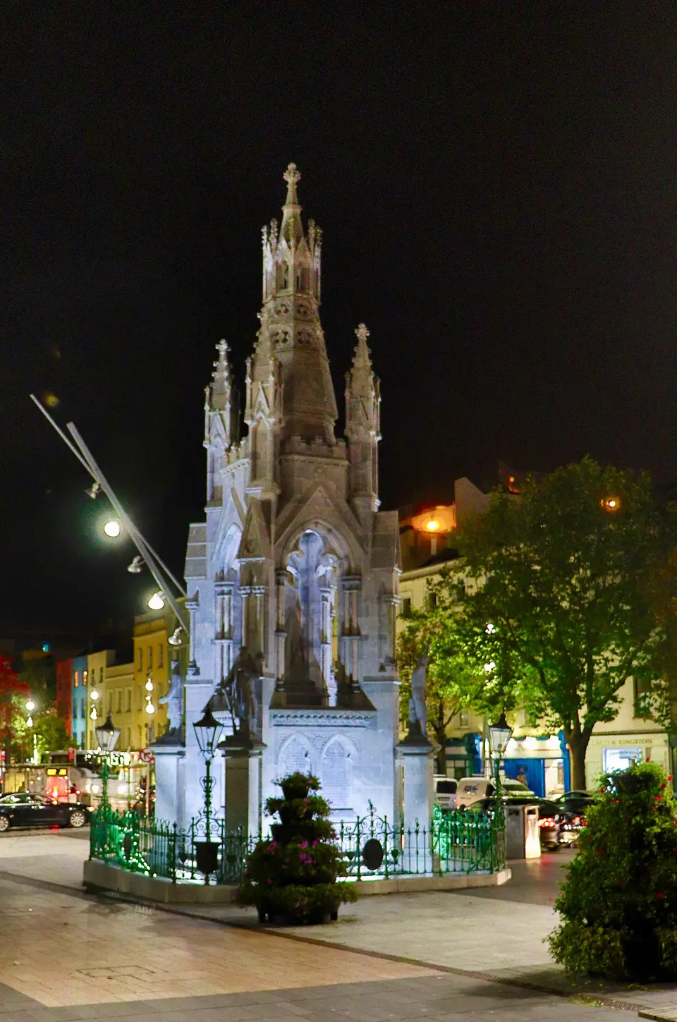
National Monument is a monument on Grand Parade in Cork, County Cork, 300 m south-west of the centre.
- Kind
- Monuments
- Address
- Grand Parade
- From the centre
- 300 m south-west, in a straight line
- Wheelchair
- Recorded as accessibleOne tag covering the whole place. It does not say whether the entrance, the inside, the toilets or the route to the door are step free, and this page will not say so either.
- Parking
- Q-Park Grand Parade, 80 m away, 350 spaces
- Bus stop
- Grand Parade (City Library), 40 m away

Getting to National Monument
About these directions
Public transport times come from National Transport Authority. Timetables cover 2026-09-18 to 2027-09-19. These are scheduled services; check with the operator for cancellations and changes before travelling.
Walking and driving times are estimates. A town search starts at its centre; choose your location or a point on the map for a more precise starting point. Eircode search is not available.
How journey planning worksDestination, access and nearby stops
National Monument is in Cork, County Cork. Routes here end at the point the map records for this place. No entrance has been verified, so the last few metres are for you to judge. Q-Park Grand Parade is 80 m away and the map records it as open to the public.
The nearest scheduled stop is Grand Parade (241461), 50 m away in a straight line. Use the planner to check walking connections for your journey.
- Grand Parade 50 m
buses 220, 216, 207, 215, 220X and 228 among othersScheduled departures from this stop
- French's Quay 180 m
buses 214 and 216Scheduled departures from this stop
- South Main St 210 m
buses 214 and 216Scheduled departures from this stop
- Daunt's Square 250 m
buses 208, 205, 214, 203 and 207Scheduled departures from this stop
- South Mall 260 m
buses 213, 203, 215, 207, 215A and 233 among othersScheduled departures from this stop
Getting to Cork covers the journeys into the town itself.
Events nearby
Not at National Monument. These are at other venues within a few hundred metres of it.
- 3 September to 25 October 2026Free entrySarah Long: Residency & ExhibitionTriskel Arts Centre
- 25 May to 28 December 2026Free entryKaraoke at Old OakOld Oak Pub
- 22 to 26 October 2026Free and ticketed partsGuinness Cork Jazz Festival 20268 venues
- 23 October 2026TicketedHayao Miyazaki's Dreams by Mystery EnsembleHoly Trinity Church, Cork
Within a short walk
What else the map names within four hundred metres of National Monument, on Grand Parade and around it.
- MTU Gallery at 46 Grand Parade20 mUniversities
- Powell Property20 mProperty management
- Clancy Construction30 mConstruction company
- Property Partners Matt Fallon30 mEstate agents
- Casey & Kingston40 mEstate agents
- McCarthy & McGrath40 mEstate agents
Also on Grand Parade
Grand Parade carries 30 of the places the map names in Cork.
- CeXElectronics
- McCabes PharmacyPharmacies
- Deep SouthPubs
- Grand ParadeBike hire
- CostcutterConvenience stores
- Phelans PharmacyPharmacies
- CentraConvenience stores
- HomeSenseInterior decoration
- Morley'sClothes shops
- Foot SolutionsShoe shops
- Shandon TravelTravel agency
- Seventy SevenRestaurants
- Eskimo PizzaTakeaways
- Fone VapePhone shops
- Boots HearingcareAudiologist
- Beauty RegainBeauty
- Casey & KingstonEstate agents
- Crowleys OpticiansOpticians
Other monuments in Cork
Nearest to National Monument first, and the figure beside each one is how far it is from National Monument, in a straight line. Same point, same measure.
- Cork War Memorial60 mSouth Mall
- Hiroshima and Nagasaki Memorial80 mSouth Mall
- Rev. Thmoas Dix Hincks200 mPrinces Street
- Fireman Richard Beecher, died 12 Feb 1975220 mWashington Street
- Centre Ward No. 5280 mSaint Patrick's Street
- Denny Lane280 mMorgan Street
- 300 m
- John Francis Maguire M.P.320 mAcademy Street
- Rory Gallagher Monument370 mPaul Street
- Richard Dowden (Richard)380 mPaul Street
- W.H. Crawford420 mEmmett Place
- Cé Lavitt510 mLavitt's Quay
Questions people ask
Where is National Monument?
What are the opening hours of National Monument?
How far is National Monument from the centre of Cork?
Are there other monuments near National Monument?
How do you get to National Monument without a car?
Where this comes from
- From the map
- The name, the kind of place, the address where the record carries one, and any website, phone or opening hours shown as recorded on the map are tags on OpenStreetMap node/3095363854, and can be corrected there.
- Worked out here
- Every distance, the nearest road where the record has no address, which car park and which stop are nearest, and the order of the lists are this site’s own calculations from those records. Distances are straight lines between two points, not walks along the footpaths, and the map will route the real walk on request. A mistake in any of this is a mistake here rather than on the map.